Darrang District
Darrang district is a district of Assam state with its administrative headquarters located at Mangaldoi town. Darrang district emerged as a separate district in July, 1983 by converting the earlier Mangaldai sub-division.
The history of the district is very old. The district has many archaeological sites such as Narikali, Tamreshwar, Bijulibari, Lakshmipur, Bhairavkund, Mathajhar, Murhadever and Dhawalpur.
The district derives its name Darrang from the Bodo word "Daurang" which means playground of the gods. In the great epic Mahabharata, it is mentioned that the present location of Darrang district was once a part of the Hindu kingdom of Kamarupa. In the beginning of the 16th century, Koch Raja Nar Narayan included this district in his kingdom. Different rulers ruled here at different times. Apart from this, during the freedom struggle, Darrang also played an important role. The local people here actively participated in various independence movements and thus contributed significantly to the attainment of Indian independence. Darrang comprises a narrow strip of plain lying between the Himalayas and the Brahmaputra River in the north-west part of Assam.
 |
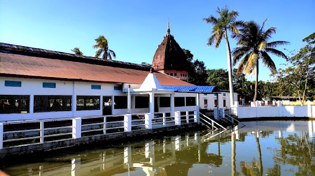
| Khatara Satra |
Attraction
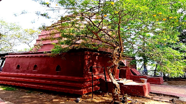
The district has many centers of attraction which attract many travelers coming from different parts of the country and the world. There are two major Satras in Darrang namely Khatra Satra and Dihing Satra. Khatra Satra is located at Dipila, 22 km away. On the other hand, Dihing Satra is situated in Kurua, 45 km away from Mangaldai. Every year a large number of pilgrims visit these Satras to celebrate the auspicious festival of Holi. Orang Sanctuary, popularly known as Kaziranga National Park, is one of the most iconic tourist destinations in Darrang district, located near Silbori on the northern bank of the Brahmaputra River. Its area is 78 square km. This is an ideal place for nature lovers. Some other notable tourist places in the district are Gandhi Smriti Park, Pathrughat Swahid Minar, Kamakshya Devalaya, Bar Masjid and Angel Baba Ki Mazar. Kamakshya Devalaya: To the south-west of Kalaigaon, near Lakhimpur village, is this temple. Inside the temple there is a statue with 8 lotus petals on it.
 |
| Sri Umananda Temple |
How to reach Darrang?
To reach here from outside the state, one will have to reach Guwahati by air, train or bus. Regular public buses run from Guwahati to Mangaldai. Taxis etc. are also easily available. The district is well connected by road and water transport system. NH 15 is the major road link passing through the district connecting the district to neighboring Kamrup, Udalguri and Sonitpur districts. The nearest airport is at Guwahati which is 77 kilometers from here.
Area
Spread over an area of 1,585 sq km, the district is bordered by Arunachal Pradesh, Bhutan, Udalguri district, Sonitpur, Kamruppur district and the Brahmaputra river. The district is divided into 6 sub-districts, 3 towns and 561 villages. Dalgaon, Mangaldoi, Pathorighat and Sipajhar are tehsils of the district.
Population
According to 2011 census, the population of the district is 9,28,500. The sex ratio in the district is 954 females per 1000 males.
Economy
The economy of the district mainly depends on the agricultural sector. More than half of its population is engaged in agricultural activities to earn their livelihood. The main agricultural products in the district are rice, paddy, wheat, pulses, oilseeds, sugarcane, jute etc.
Education
The district is known to be home to many prestigious educational institutions. It provides a platform for higher educational institutions. According to 2011 census, the literacy rate in the district is 63.08%. Mangaldoi School, Don Bosco School, Sipajhar H.S. And M.P. School, Glorious Public School, Khoirabari College, Sipajhar College, Mangaldai College, Mangaldai Commerce College are some of the best institutions in the district.


Comments